Hopping Clouds

  • Home
  • About
    • About Me
    • Collaborate
  • Destination
    • Malaysia
    • Singapore
    • Indonesia
    • Hong Kong
    • Taiwan
    • China
    • Japan
    • South Korea
    • USA
  • Food
  • Fun Stuff
  • Say Hi
Powered by Blogger.
We woke up at 5am to get ready for our hike. We thought it would still be dark like in Singapore but the sun rose very fast in Jeju. By 6.00am we were on the road heading towards Hallasan (한라산). We were worried about weather reports and debated whether to take along our thicker hiking jackets. That morning was predicted to be 3C!

We chose Seongpanak Trail (9.7km) both ways as it was closer to where we were staying. The drive was really lovely but be careful! The roads tend to wind a bit. Some folks may choose the other trail Gwaneusa (8.7km) to descend as it is steeper and a shorter route but that's on the other side of the trail for us. It wasn't worth hitching a ride all the way back to our car.
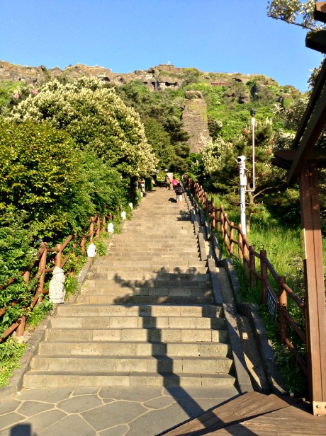
Seongpanak Visitor Centre
You see the yellow board on the bottom left of the photo above? That's where visitors were supposed to register. Admission is free. If you want to get a certificate for climbing Hallasan, you have to make it back down before 4pm to get the certificate (with your name on it) for around KRW1,000.

Empty your bladder at the Visitor Centre, it's going to be a while before you see the next toilet.


The hiking information board says the first part of the trail is 4.1km. It sure didn't feel like 4.1km. Although a gentle slope upwards, it felt like a 5.5km.


800m only?! This was after half an hour after departing the visitor centre

We reached Sokbat Shelter (toilet break!) after 2 hours of walking. The unusual thing about toilets at the Sokbat Shelter is that it uses bubble foam to flush toilets. This is to conserve water supplies and also keep the smell at bay. There is no food available at this shelter so press on! 

The pine forest greets you after Sokbat.


If you came in spring, this would be a brook


First glimpse at Jindallaebat Shelter. The sun was beating down on us and whatever weather forecast in the morning of of gloomy and cold skies! I started to strip off the layers and continued my hike in a sleeveless T-shirt.

This is the last stop before the last stretch upwards to the peak. You should reach here just before lunch to grab a meal of instant ramen. By the way, the instant ramen tastes awesome during the cold weather. There are no trash bins along the trail there. If you are lucky, you may see some park stuff making their cleaning rounds and you could ask if you can dispose of trash with them. However, hikers are expected to bring their trash down the mountain for disposal. So, pack responsibly!

It's a very Korean experience to eat ramyeon here.
The next part of the trail was much steeper than the earlier parts. I think I over packed by the way. I tend to do that - maybe part of the Girl Guides/Scout training instilled in me to be prepared for anything. I also tend to run into scrapes more often than many other people.

Tall pine trees gave way to low shrubs and then just barren land. Perhaps, spring hasn't really knocked on nature's doors yet. This part of the trail was labelled as the most "difficult" of the hike but given the other hikes I have been on, this is probably a more vigorous romp. I saw many hikers outfitted with sneakers and barely a bottle of water. You can try doing the sneakers but not the water. Seriously, you will need the water.

The stone steps getting taller as you approach the peak. The bare stones and ravens (yes, they are huge) could probably be a set for one of those Alfred Hitchcock movies.


There is only one building manned by a park ranger at the peak. No other shelter apart form that.


We spent an hour soaking in the views and getting our energy up for the hike back down. When we were getting ready to leave, the ravens started cawing loudly. Their caws echoed off the mountains. The park ranger announced (using the PA system mounted to the building) that a storm was approaching and everyone had to get off the mountain. Those who just arrived were turn around immediately and leave. Were the ravens some sort of natural weather system?

We hastened our steps to get in front of the departing crowd.

Sunlight faded at a pretty quick rate and we didn't fancy getting a sprained ankle with all the rocks. We passed a herd of indigenous deer on the way down. Barely visible in the dimming light. I didn't stop to look, I was rock hopping all the way down to reduce the pressure building up in my wonky knee.

When everyone reached the car, we packed and called it a day. Our reward for the climb? Meat.


This trip to Jeju Island is a UNESCO treasure hunt.

When we sorted out the accommodation at Doldam, it was already post lunch. We quickly headed out to a neighborhood restaurant recommended by Su and had the best meal throughout our trip! I'm not exaggerating. Everything was so fresh and the ahjummas were being quite generous in our portions. We were a dead giveaway as first timers to Jeju.
This isn't even the full spread yet!
After our bellies were full with our first Jeju meal, we started up the GPS and made out way to Seongsan Ilchubong Peak (성산일출봉). This is the first on our Jeju UNESCO check off.

Seongsan Ilchubong Peak means sunrise peak and it's the go to place to greet the sunrise for the new year. It's located at the end of the eastern part of the island. We were rushing to make the sunset instead. We were told that the sunset is awfully pretty there.


On our way there we passed fields of rapeseed flowers in full bloom with native ponies wandering around! It looked like a scene out of those travel magazines that makes you wonder whether it has been Photo-shopped. We promised each other that we would definitely have a romp in the fields on the way back.

Seongsan Ilchubong  was formed from under the sea from a volcanic eruption. At the top of the mountain, there a huge bowl like crater. From an aerial view, it looks like an ancient castle. There are a few trails to get to the top of the peak, offering different views. You many not come down the same way you went up so choose wisely.

Luckily for us, the crowds were dwindling when we arrived.  We weren't sure how strenous this walk around the peak would be considering we were going to the highest point on the entire island the next morning. We were very surprised that the Seongsan Ilchubong was quite leisurely considering it was supposed to be a small mountain.


If you want to try your hand at the trails here, I would suggest a decent pair of sneakers. Lots of stairs everywhere.
Dusk is starting to settle

This is the crater at the top of the mountain
On our way down, the hanyeos have left for the day. This cove is where they would collect shellfish and sell to tourists.
It took us about an 1 1/2 hours as we took our time making our way back to our rental car, while enjoying the evening breeze.

We didn't forget the flowers on our way back. I would have loved to have spent more time in the fields if the sun wasn't setting at an extremely fast rate.

Since we would pass Seogwipo, we hopped into a shop selling ox bone soup to fill ourselves up. The winds in Jeju get very strong and cold in the evenings. The ox bone soup really hit the spot. We were actually looking for black pork BBQ but this soup place turned out great!


We wandered around after dinner and bought some breads from the local bakery for the next day's adventure. Most eateries in Jeju has an English menu (including the bakery) so we were quite happy eating our way around.

After the whole day of flying, training, walking and driving, we were tired to our core. We could barely keep our eyes open as we packed our hiking gear for the next day. Not to mention the sound of waves lulled us to sleep in no time.


Seongsan Ilchubung Peak
Address:284-12, Ilchul-ro, Seongsan-eup, Seogwipo-si, Jeju-do
제주특별자치도 서귀포시 성산읍 일출로 284-12
Tel: +82-64-710-7908 /+82-64-783-0959 (Guided tours available)

Admission Fees:  Adults 2,000 won/teens and children 1,000 won


Our maiden trip to Jeju Island involves hiking, lots of hiking.

Doldam Guesthouse, with its proximity to the sea and Hallasan and great reviews on Tripadvisor pretty much sold it to me. Plus they have a dog!

Su from Doldam responded to our endless questions patiently about Jeju and her guesthouse. I quite a paranoid person when it comes to accommodation. I wouldn't be surprised if the thought of cancelling our reservations crossed her mind!

She also helped us make the arrangements for our rental car at a decent price. It was much cheaper than getting it on our own. We honestly have no idea where we were driving to when we got our rental car on Jeju Island. The roads there have a habit of hiding behind bushes or at a sharp corner. The locals behind our little white car probably would have loved to nudge us off the cliff as we crawled along looking for an obscure road.

As our GPS beeped, the way we were on opened up to Daepyung Sea Village. What a jaw dropping moment!

 The GPS showed that the guesthouse was just right around the corner but we couldn't resist the amazing view! I mean just look at it!


A light tower with a statue of a lady enjoying the sea breeze
Doldam is the Korean word for 'stonewall' and there are stonewalls everywhere in Jeju! The stone walls in Jeju serves multiple purposes like land boundaries, protecting agriculture and lifestock and also to prevent the rich volcanic soil from blowing away!

A couple of statues greeted us as we pulled into the driveway. I think it represents the owners, Mr. Kim and Sue. They were originally from Seoul and relocated to Jeju Island to start a slower pace of life. Sue told me that when they decided to settle down on Jeju Island, Mr. Kim took 2 years to look for a plot of land which overlooked the sea. With the view that greeted us each morning, all that walking Mr. Kim did over the island certainly paid off!


The adorable scruffy dog

 
Dining area of Doldam where we had breakfast
Su makes her own tangerine jams and it makes a great souvenir for home.

We had a family room on the ground floor where the view opened up the the garden. It was comfy enough with lots of space for our hiking gear to be splayed out. The toilets were very big with lovely hot water.


On the 2nd day we were moved up to another family room as they had some elderly guests coming in and stairs were a problem. We were glad to change rooms because it gives us another opportunity to see what else this house had to offer.

We got a night sky full with stars as we hung out on the balcony. The room was slightly smaller than the first room we had but we still had quite a bit of space between us.

Doldam offers dinner for a fee but if you want to other dining options, there are a few decently priced restaurants around the neighbourhood within walking distance. Alternatively, take a drive to Seoqwipo for more awesome food!

Doldam Guesthouse
Address: Daepyeongro 46 대평 로 46) 돌담 에 꽃 머무는 집, Daepyeong-li, Seogwipo-si, Jeju-do, South Korea
Tel: +82 10-4536-1955
Price: SGD$$$ per room

My friends thought I was nuts. The conversation usually went like this

*flashback*

Friend A: Where are you going this year?

Me: Just heading out to Hong Kong

Friend A: It's not time for the summer sale yet.

Me: I'm not going shopping.

*cue funny look from Friend A*

Friend A : Thennn...

Me: I'm hiking

Friend A: Hong Kong? Hiking? Are you sure there is a place to hike in the concrete jungle? You mean that you are hiking through the departmental stores...rigghhttt?

Me: Nope, I'm really going hiking. Grass, trees, rocks.. hiking

Friend A: Okaaayyy... *gives me the you-are-crazy look*

The Hong Kong Tourism Board does a great job promoting its hiking trails to tourists - http://www.discoverhongkong.com/us/see-do/great-outdoors/index.jsp. If you drop by the Hong Kong Tourism shop right after you collect your luggage at the Hong Kong International Airport, you can pick up a a hard copy solely focused on outdoor trails and parks. With this book, it gives something to the hikers to do while their friends go shopping at Causeway Bay.  If I had more days there, I would have probably done another trail.

A few trails were considered - Sunrise Peak, Lamma Island and Maclehose Trail. After much deliberation and it's our first time hiking in Hong Kong, we decided to go with Maclehose. The trail is named after a Hong Kong governor named Sir Murray Maclehose, who looked after the colony from 1971-1982. He was the one who started the MTR project and started many new villages to accommodate the boat people and those escaping from Mao's Cultural Revolution.

We got some advice before setting off on our trips from friends who were stationed on the island. As I was used to hiking in the humid jungles of our Equatorial-ish countries, I was surprised when I was informed that no guide is needed even if you did the whole 100km of the Maclehose trail. All trails have markers spaced out every 500m or so. The markers also serve a function to let people know in case you get lost. Yes, you will still be able to get cell phone reception.

The sky was downcast when we woke up at 7am to gear up for the long walk. It was still undecided whether to do Trail 1 or Trail 2 or both.
Breakfast at a random char teng - I can't hike on a full stomach. 
We took the MTR to Diamond Hill and at the bus interchange, we got on bus 92 to Sai Kung town. It's the last stop so we didn't have to worry about counting bus stops or anything like that.
On bus 92 heading to Sai Kung. The weather got worse.
The rain was still drizzling as we got off the bus at Sai Kung. A choice needs to be made on which trail to take. Although we had brought out ponchos. we didn't want to be stuck in a rain storm. The weather was supposed to be clear according to the weather forecast but a freak storm was upon us. Chancing upon the Sai Kung Visitor Centre, we got advice from 2 friendly aunties on how to go about our trip. They were hikers themselves and not some weak paper-pushers. Since I was the only Cantonese speaker in our group, it was left to me. Turns out that these seasoned hikers suggested that we give the first half of Trail 1 a miss since it was just asphalt and dust. They suggested that we should take a green taxi from the taxi stand near the pier all the way up to the High Island Reservoir and start from there as it would save time. Plus, they say we would have time to appreciate the amazing views it has to offer.

Sai Kung town is the last stop to stock up on water and snack bars before heading out. It will be awhile before we run into civilisation.
Cute paper boats sculptures at the visitor centre
On the way to the taxi stand
Grateful for their advice, we made our way over and caught a cab in no time. It didn't cost more than SGD20 for the cab to bring us all the way up to the reservoir. Luckily we did too. Otherwise all our energy would be spent on climbing a gravel road all the way up.
This looks like a freaking sea! But it's all fresh water!
Levee that separates fresh water from salt water


The High Island area has been designated as a Geo-Park as the you can see hexagonal columnar joints from different angles and even get close to them. These rocks are shaped as if man took a tool to them but it's all natural. Neatly arranged by lava, gravity and erosion, it was quite amazing to see stacks of these rocks rising up.

The winds are really strong and cold at the dam. We saw a couple taking wedding photos there and the bride was a wee little thing in a short puffy skirt. I had an image of winds blowing her away.

This trail is famous for its isolated beaches, accessible only through the hiking trails or by boat. We started at at 11am at a good pace and 20 minutes later we crested a hill. Nature said hello.

Long Ke Wan (浪茄灣) popped up with a sandy white beach. We were unprepared when it appeared from behind a hill. The view was amazing. We were chatting about how the other beaches would look like if the one "nearest" to civilisation looked like this.
Hexagonal rock columns by the bay


As we headed to the beach, we passed by a Christian drug rehabilitation centre for youths. In a way, it was the perfect place, there is no escape, no temptations, except for the sea and hills all around.
South China Sea dead ahead
There was a group of expat hikers in front of us when we started. They joined some sort of hiking group to bring them in. They broke out picnic gear when they reached and informed us that this is the last stop for them. They started halfway up Section 1 and ended here. We wished them a pleasant stay and continued on. That is one thing I really like about hiking, you get pretty decent people on the trail. You hear greetings, people descending making way for people heading up etc. Of course you come across some typical I'm the king of the hill types. Those just need to be thrown off.

The weather got worse when we left Long Ke Wan. Winds picked up speed and a heavy fog settled. I couldn't take many photos then as I was more worried about wandering off the marked trail in the fog.
Starting the uphill climb towards Sai Wan Shan  (西灣山). Weather was starting to turn bad
We could hardly see 5 feet in front of us. My friend sent a photo back to office with the tag "Where in blazes are we?!"
We later figured out why the weather took a change all of a sudden. We hiked right into a typhoon warning level 2! Well, that's one off my bucket list - hiking into a possible typhoon, check!

The path from Long Ke Wan to Sai Wan isn't paved but its a nicely packed dirt track. We took a couple of breaks at the pavilions to have lunch and snacks. The warm food and drinks helped us through the cold winds. MG and I looked a little like crazy bag ladies. An was being her radiant self. At the pavilion we passed a group of collage boys who looked like they were going to camp at one of the beaches. They even brought a bag of booze, with all their camping gear and tents! The girls looked at each other and had the same thought, "if we were 10 years younger and didn't have to work for our keep."

The storm finally let up and caught our first glimpse of Sai Wan (西灣).
We hurriedly made our way off the mountain and into the marshlands.
On the way to Sai Wan
There were more people here as there is a small fishing village located at Sai Wan. They also cater for hikers with little refreshment stalls. There is even a surf school here! Here is a good place to refill your water packs if you are empty by now.
Sai Wan Village is also accessible by bus from Sai Kung town with a 30 minutes hike from the bus stop. The beach here was just okay. Probably due to the high human traffic. If you want to camp, the beach is better 5 minutes away from the village. There is a helipad built behind it with a pretty decent toilet with bathing facilities.

In the summer, this village holds a different attraction. There is a natural rock pool 10 minutes away which known for cliff-jumping activities.

When we made our way through the village (the trail actually cuts through the village), wwe realised a  number of  houses are no longer inhabited. It's sorta sad, really. Modernisation...people leaving for greener pastures...

What do you do when you leave your house? Use a stick. To prevent trespassers, the villages just put a stick across the door. That's it. No locks. Just a long wooden stick.
Sai Wan's cleaner beach
Someone pitched a tent on Sai Wan beach and brought a couple of Labradors. I wished I could have stopped hiking and pitched a tent on my own. It was calming to face the sea with only your thoughts. To see what you are, what you were and what is to be. 


The trail snaked uphill again after Sai Wan. There is one more beach  along Tai Long Wan, beyond the ridge. After a 45 minutes walk while avoiding of cow dung, Ham Tin Wan (鹹田灣) revealed itself. Yes, you did read it right. Cow poop. EVERYWHERE. These wandering cattle are descendants of those let lose when the government gazetted farming land for the reservoir and conservation parks. You hear a rustle in a thick bush and suddenly a bovine stares at you while munching.

Get this, you would think cows prefer the grassy trails? Wrong, these animals take the paved road.


Descending again
Ham Tin Wan, the place to surf
At Ham Tin Wan, there are a couple of  restaurants where you can get a bite or rent camping gear for  night on the beach. There's quite a bit of vegetation around here so beware of the mosquitoes. It was 3pm when we reached this beach. We could have probably reached faster but we took our time and just soaked in the amazing sights along the way.

After Ham Tin Wan, you don't really get to see many people on the trail, if you can call it a trail. There is no 1 single clear path so we just kept our peeled for the trail markers that  spaced out every 500m or so. We had to double back once because we lost sight of the markers. This part of the hike was relatively flat and moving through alot of sand. After the sand, comes the jungle. We got the paved path again at this point. Our pace quickened as we did not want to wander around in the darkness when dusk hits.

After 1 1/2 hours going up and downhill on a very steep gradient, we stumbled into an old Hakka village. Some had inhabitants but most of them looked like the owners got up one day, locked up and left. It really looks like the owner went to the farm and will be back real soon. That's when our imagination started to run wild. It was a ghost town or village in this case. We met a kind old farmer and he assured us that we were on the right track.

 We all heaved a sigh of relief when we saw this sign.
 We knew that our hike was nearing it's end when we passed the camping grounds near Chek Keng

(赤徑). This place is actually accessible by ferry from the Wong Shek Ferry Pier. So for those who wants

a shortcut, here it is. After the awesome sights the earlier beaches gave, this beach was a little sad and abandoned. I'm not sure if the overcast weather just make everything look a little more glum or it was just me. 
 More creepy villages on the way out. At this point we were really hurrying.

 We brought out our headlamps around 6pm. It was really dark as we hit another part of the jungle/overgrown farmlands.Street lamps were few and in between. Luckily we ran into some people on their way out too. Imagine our joy at seeing humans after creepiness of the empty houses. Yay for people!

The hike ended around 6.45pm at Pak Tam Road. A couple of hikers showed us where the bus stop is. It's difficult to spot it at night as it was located in a dimly lit area, 100m from the left of the sign above on Pak Tam Road. Another way to know whether you are standing at the right spot is that you will see Maclehose Stage III starting sign across the road from where you are waiting for the bus.

Bus 94 came along and we climbed on board back to Sai Kung town for dinner.

Hidden pristine beaches accessible only by hiking. There is a whole lot more to Hong Kong that meets the eye.

Maclehose Trail Stage ending half of 1 & whole of 2
Getting there: Diamond Hill MTR ► Bus 92 at Diamond Hill Bus Interchange ► Sai Kung Bus Interchange ► take green cab to Reservoir.
Getting back: Pak Tam Road bus stop (left of sign) ► Bus 94 to Sai Kung Bus Interchange ► Bus 92 to Diamond Hill Bus interchange ► Diamond Hill MTR
Older Posts Home

ABOUT AUTHOR

Wishing travelling was a full-time job ;)

POPULAR POSTS

  • Broga Hill, Malaysia
  • The Ship @ Damansara Uptown
  • Yan Wo Dou Bun Chong Soya Bean Curd (人和豆品廠) @ Causeway Bay, Hong Kong
  • Hidden Tomato Noodles @ Star Cafe (星座冰室) Tsim Sha Tsui
  • SNOWFLAKEs everywhere!

Categories

Adelaide 4 Australia 3 Bali 7 Books 1 Borobudur 3 Breakfast 5 Brunch 4 Cafe 13 Dessert 1 Food 42 Hiking 19 Hong Kong 4 Hotel 7 Indonesia 11 Jeju 3 Jiu Fen 3 KL 2 Kota Kinabalu 7 Local 1 Malaysia 4 Pinnacles 7 Restaurant 10 Singapore 24 South Korea 4 Taipei 7 Taiwan 12 Travel 57 UNESCO 4 Vietnam 6 Work 3 Yogyakarta 1

Advertisement

FOLLOW ME @ INSTAGRAM

About Me

Popular Posts

  • Broga Hill, Malaysia
  • The Ship @ Damansara Uptown
  • Yan Wo Dou Bun Chong Soya Bean Curd (人和豆品廠) @ Causeway Bay, Hong Kong

Advertisement

Copyright © 2016 Hopping Clouds. Created by OddThemes